Direct students' attention to the Making Predictions from Best-Fit Lines pages in the Student Guide. Begin the lesson by asking the students to read the story “The Ghost Galleons.”
This story can be assigned as independent reading before reading and discussing it together in class. Students can read it individually, with a partner, or in a small group.
Use the discussion prompts to help guide a class discussion about the story “The Ghost Galleons.”
Page 332
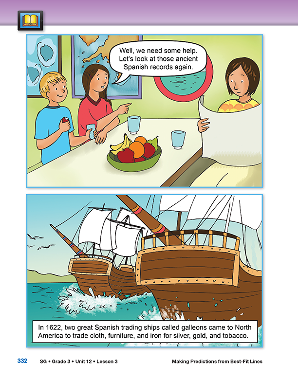
In this story two children are on a trip to the Caribbean searching for the wreckage of two Spanish galleons. A galleon was a large multi-decked sailing ship used from the 16th to 18th centuries. This is a fictional story based on the true story of the Santa Margarita and the Atocha in 1980. See the Unit Resources section of the Unit Outline for the National Geographic article on which this story is based.
- About how long ago was the year 1622? (It was about 390 years ago.)
Page 333
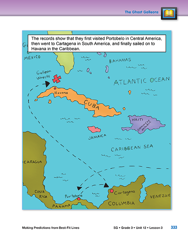
This map shows the route taken by the two Spanish galleons.
- Where are the places on this map in relation to the United States? (The map shows the southern tip of Florida. It also shows the Caribbean Islands, the northern tip of South America, and part of Central America. They are all to the south of the U.S.)
Page 338
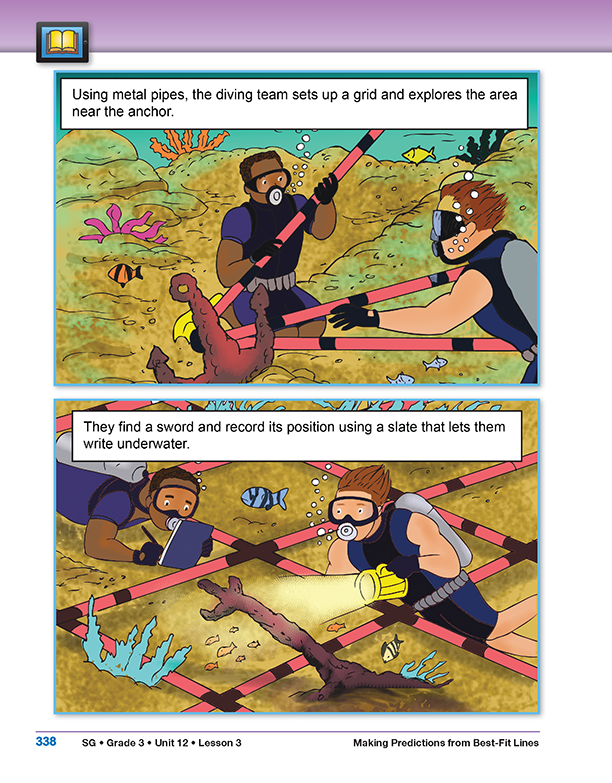
Grace and Nicholas, along with the diving team, set up a grid on the sea floor using metal pipes. This helps them to record the location of each of the items that they find.
- How is the metal grid they used like the grid on a map? (The metal grid they used helps them to know the location of each item on the sea floor. They can record the coordinates for each object)
- What did the diving team use as the starting point or origin of their grid? (They used the anchor.)
- Why do scientists record the position of everything they find from a shipwreck? (They map the location of each item because it might be a clue that will help them find the shipwreck or other items from the ship.)
Page 340
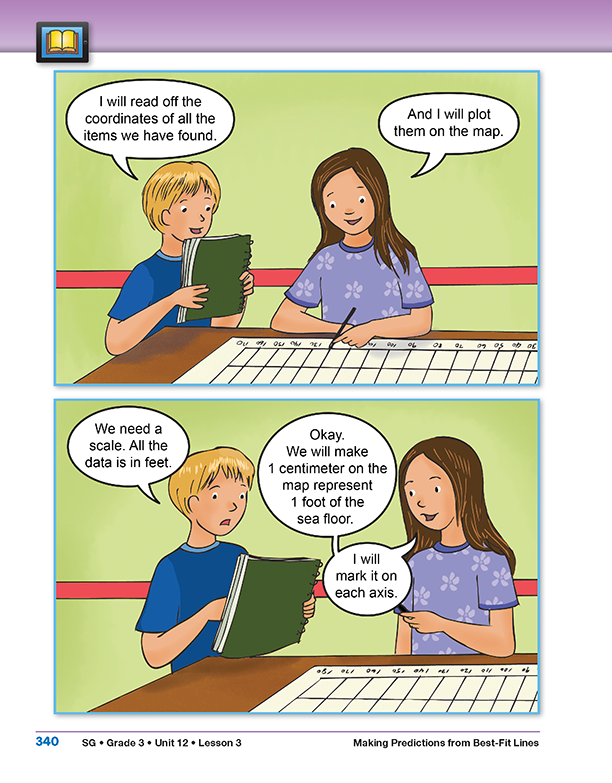
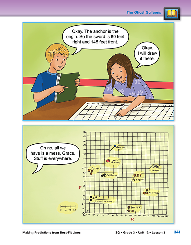
Nicholas and Grace decide to make a map to show the location of all of the things they found on their dive. The scale they chose for their map was 1 centimeter on the map equals 1 foot on the sea floor.
- Why did Nicholas and Grace need to scale their map? (Their map is much smaller than the area on the sea floor where the items were actually found.)
Point out that in the illustration, the map that Nicholas and Grace made takes up most of the table, and then ask:
- Can you think of another scale that might have been reasonable for their map? (Possible response: They could make a map with the scale of 1 centimeter equals 10 feet so they could have a smaller map.)
Page 341
Nicholas and Grace drew pictures on their map to represent the objects they found.
Have students study the map they drew and then ask:
- What do the R and F on the map represent? (The R stands for right and the F stands for front.)
- Why are they important? (They tell you what direction you are moving on the map so it is easier to find the location of an object.)
- Nicholas said that all he saw on the map was a mess. Do you agree with him? What patterns do you see? (Possible response: Most of the things that are made of metal and are heavy are on left side of the map and most of the pottery is on the right side of the map. The things they found are spread over a larger area.)
Students may not readily see a pattern of objects. If they are unable to answer, direct them to continue reading to see what patterns Grace uncovers.
Page 342
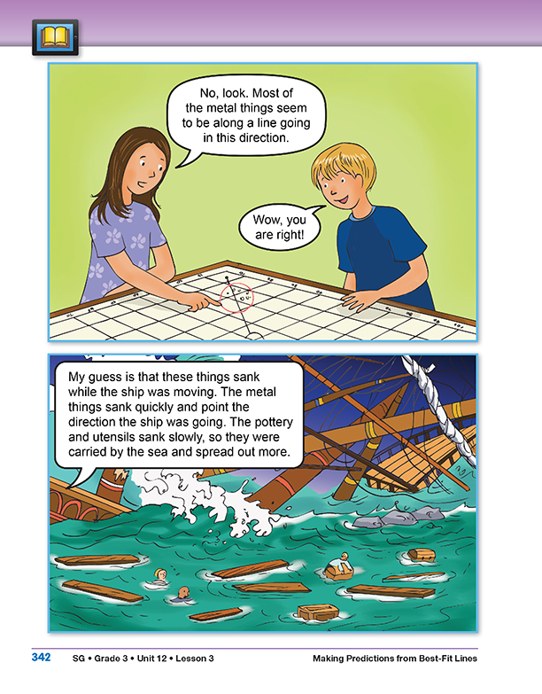
Grace thinks that the heavier metal objects show the path the ship was traveling when it sank. She drew a line to show her thinking.
Have students look at the map and then ask:
- What are the metal objects that are shown on the map? (The cannon balls, the chest of coins, the sword, and the utensils are all likely made of metal.)
- Why do you think most of the pottery and the utensils are not in line with the cannon balls, chest of coins, and the sword? (Possible response: They are lighter so they drifted in the water as they sank to the bottom. The cannon balls, chest, and sword were probably heavier so they sank faster.)
- Why did Grace draw a line on the map? (The line shows the path of the metal objects along the sea floor and makes it easier to see pattern.)
The line that Grace draws on her map is called a best-fit line. A best-fit line is a line that comes as close to fitting the data points, in this case the metal objects on the map, as possible.
Page 344
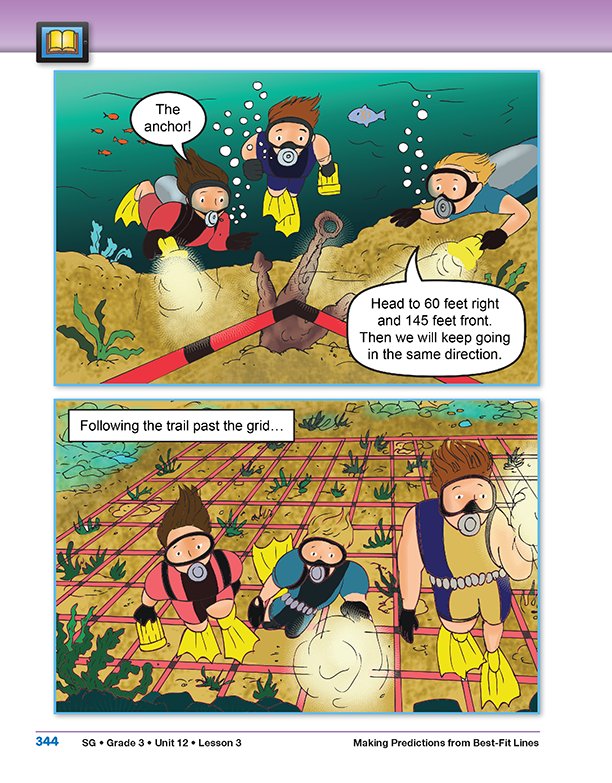
The next day, Nicholas and Grace started off early to see if the prediction they made using their map would help them find the sunken ship and the treasure.
- Where did Grace and Nicholas start their journey? (They started at the anchor.)
- Why did they decide to start there? (The anchor is at the origin of their map and of the grid on the sea floor.)
- Nicholas said they needed to go 60 feet to the right and then 145 feet to the front. What will they find on the sea floor at that location? (That is where the sword is located.)
- Why do Nicholas and Grace plan to continue swimming in that direction past the sword? (They used their map and the pattern of the metal debris to predict the direction the ship was traveling beyond where they found the sword.)