


Meet Mr. Origin
Est. Class Sessions: 1–2Developing the Lesson
Part 2: Identify the Location of an Object
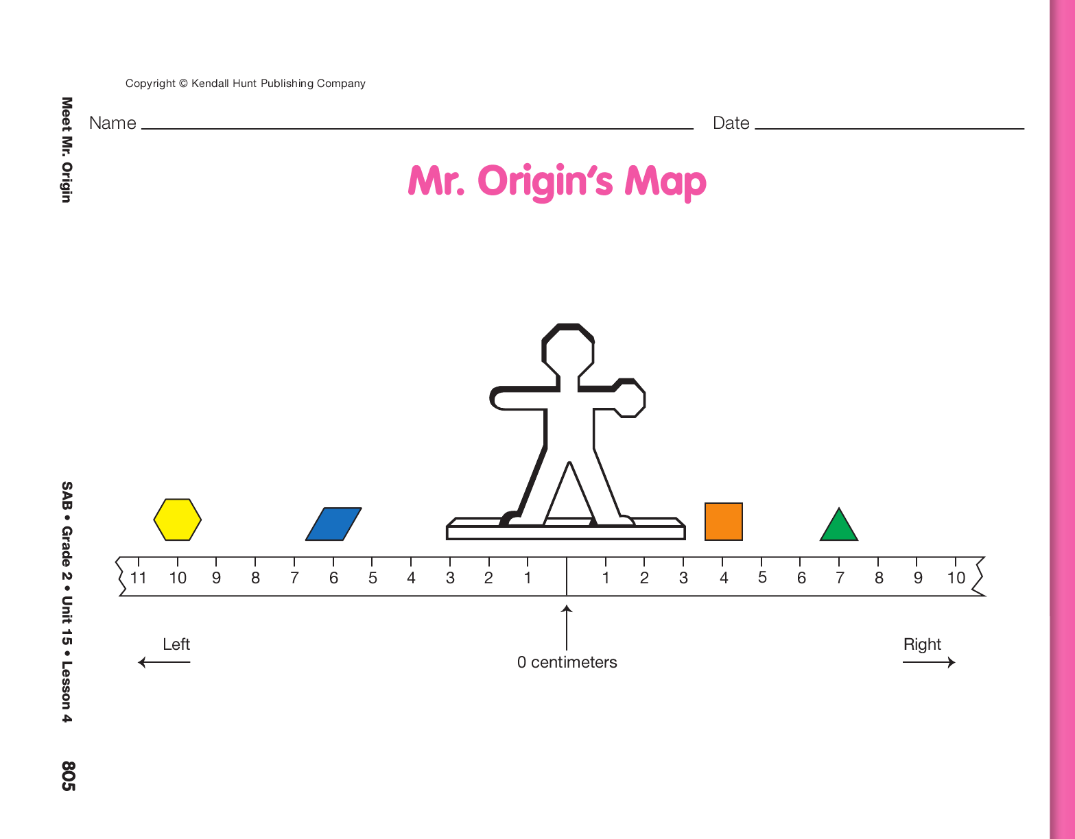
Define Origin. Show students the model you prepared of Mr. Origin’s Map. See Materials Preparation. Display and direct students to the Mr. Origin’s Map page from the Student Activity Book. Point out the correspondence between the actual model and the display of the map.
Ask:
Explain that the zero on this map is called the origin of the map. Origin is a mathematical term that means “the place from which we start a measurement.“ Mr. Origin was named because he is always placed with his button, center, just above the starting point, or the zero. He is also always placed with his back facing us so that his right hand points to the right side of the paper. Direct students to use their finger to show where the origin is on their page as you quickly scan the room to make sure students can identify the origin.
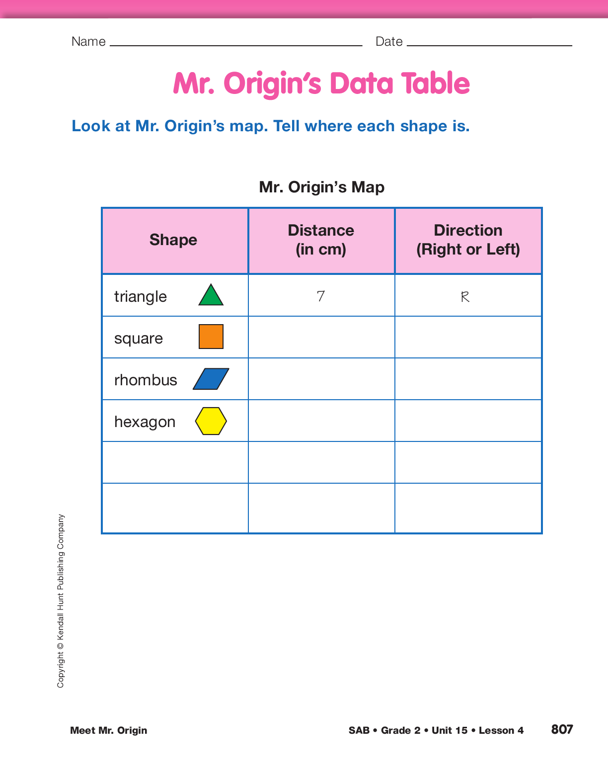
Ask students to look at the Mr. Origin’s Data Table page in the Student Activity Book.
Introduce the data table with this short vignette:
Ask students to use the Mr. Origin’s Map page to confirm Sam’s location of the triangle.
Ask:
Describe Location of Shapes. Have students work with a partner to find the location of each object on the Mr. Origin’s Map page and complete the data table. After several minutes, display the Mr. Origin’s Data Table page from the Student Activity Book. Ask several students to help you fill in the location of each of the shapes on Mr. Origin’s Map. Add a trapezoid to the shape column of the display and tell students that Sam decided to add a red trapezoid to Mr. Origin’s Map. Explain that he used the data table to describe the location for the trapezoid as 8 centimeters to the left of Mr. Origin. After adding this information to the display of the data table ask students to use their Mr. Origin’s Map page to decide where Sam should place the trapezoid on the map. Ask students to either sketch a trapezoid or draw an X where the trapezoid would be on their map.