Read “Lords of the River: The Giant Otter.”
Read the Adventure Book story, “Lords of the River: The
Giant Otter,” aloud to the class. Establish the context
of the story by showing students the location of the
Amazon River on a map or globe. Share that the
Amazon River is about 3900 miles long and that the
main characters, Betty and her father, are exploring a
section of the river. Use these or similar prompts to
guide a class discussion about the story:
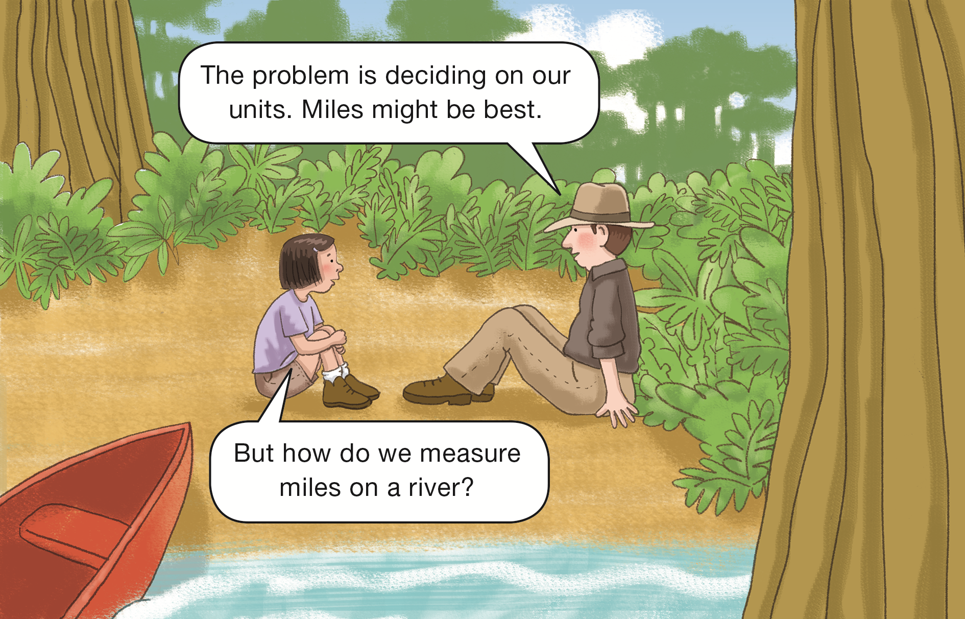
Pages 5–6
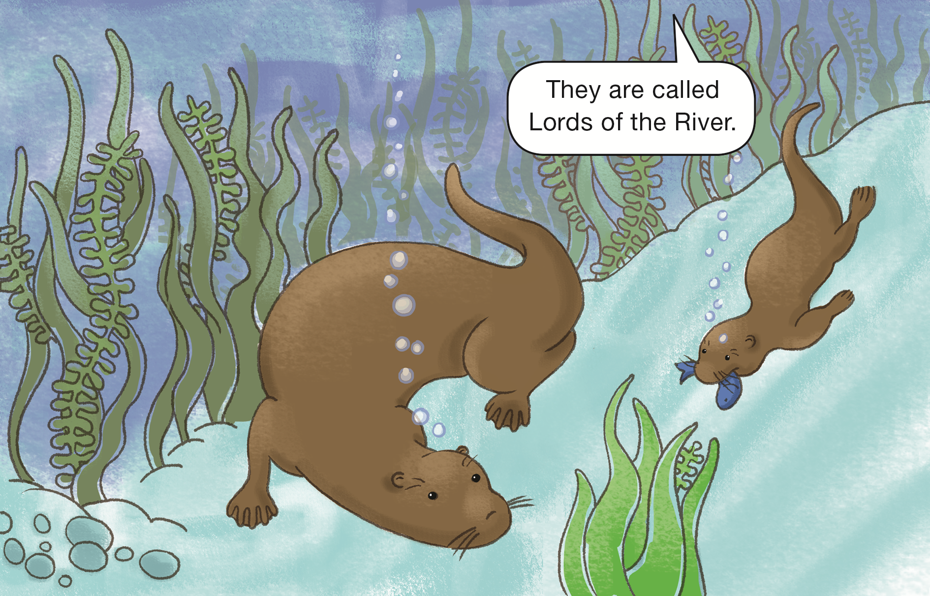
- Why do you think the giant otters are called “Lords of the River”? (Possible response: The
giant river otter is the largest animal in the river environment.)
This South American otter is the world's largest, at some
6 feet (1.8 meters) long. It lives only in the rivers and creeks
of the Amazon, Orinoco, and La Plata river systems.
Giant river otters live in family groups that include parents
and the offspring from several breeding seasons. Giant river
otters are social, typically forming groups of 4–8 individuals
(though congregations of up to 20 individuals have been
observed).
They den by burrowing into banks or under fallen logs, and
establish a home territory that they will aggressively defend.
Young otters remain in the den for a month but grow up
quickly. After nine or ten months, it is difficult to tell mother
from child.
Giant river otters have been hunted extensively and are now
among the most rare otters in the world—only a few
thousand are believed to survive in the wild.
Pages 7–8
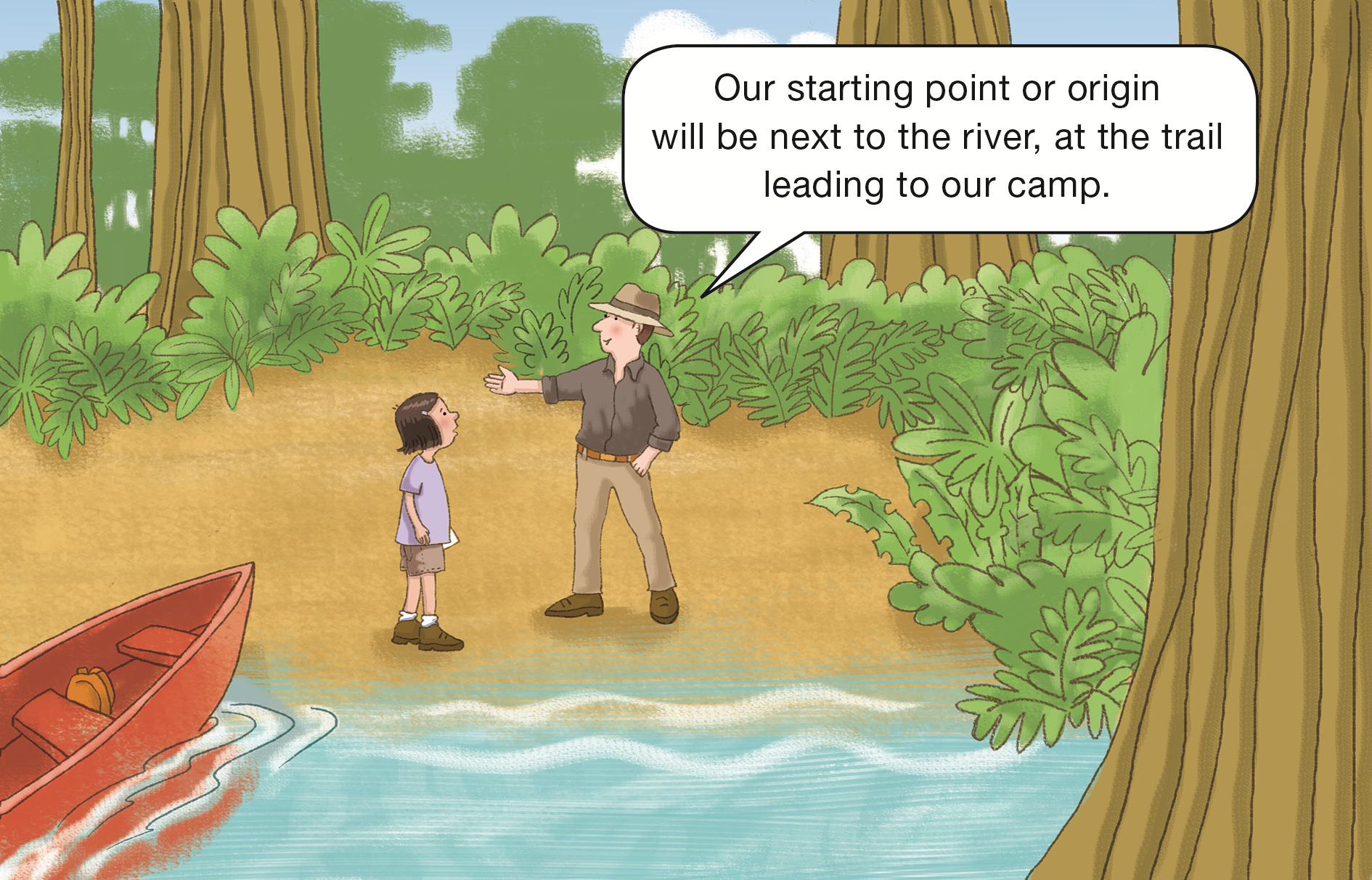
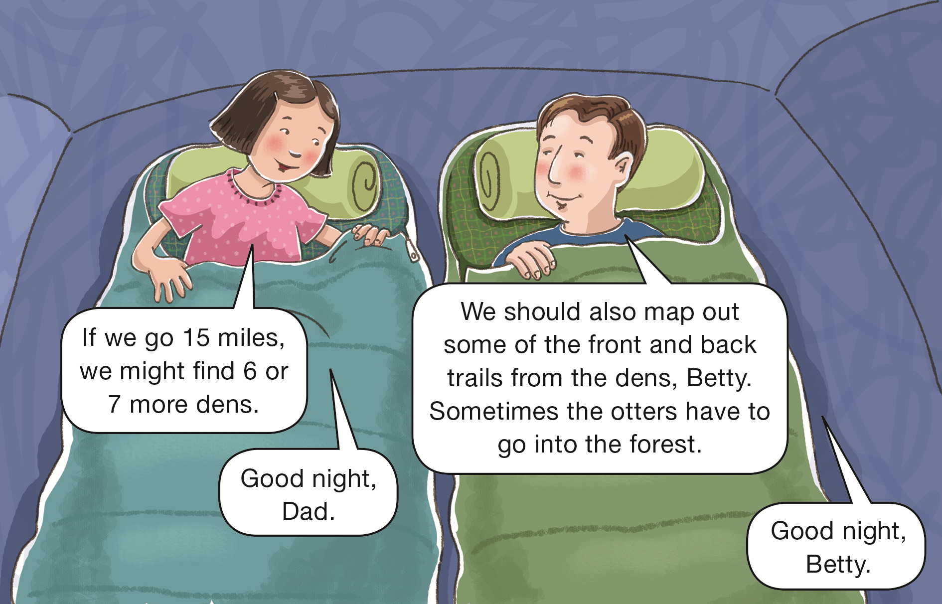
- Look carefully at the picture of Betty’s father. How
is he like Mr. Origin in this part of the story?
(Possible response: He is standing with his arm
pointing right and is helping Betty figure out
directions along the river.)
If students are having difficulty identifying how Betty’s father
is similar to Mr. Origin, provide them with a figure of
Mr. Origin from Lesson 4. Ask them to set the Mr. Origin on
their desk so his front side is facing them. Now have them
look at the picture and compare the picture to the Mr. Origin
figure.
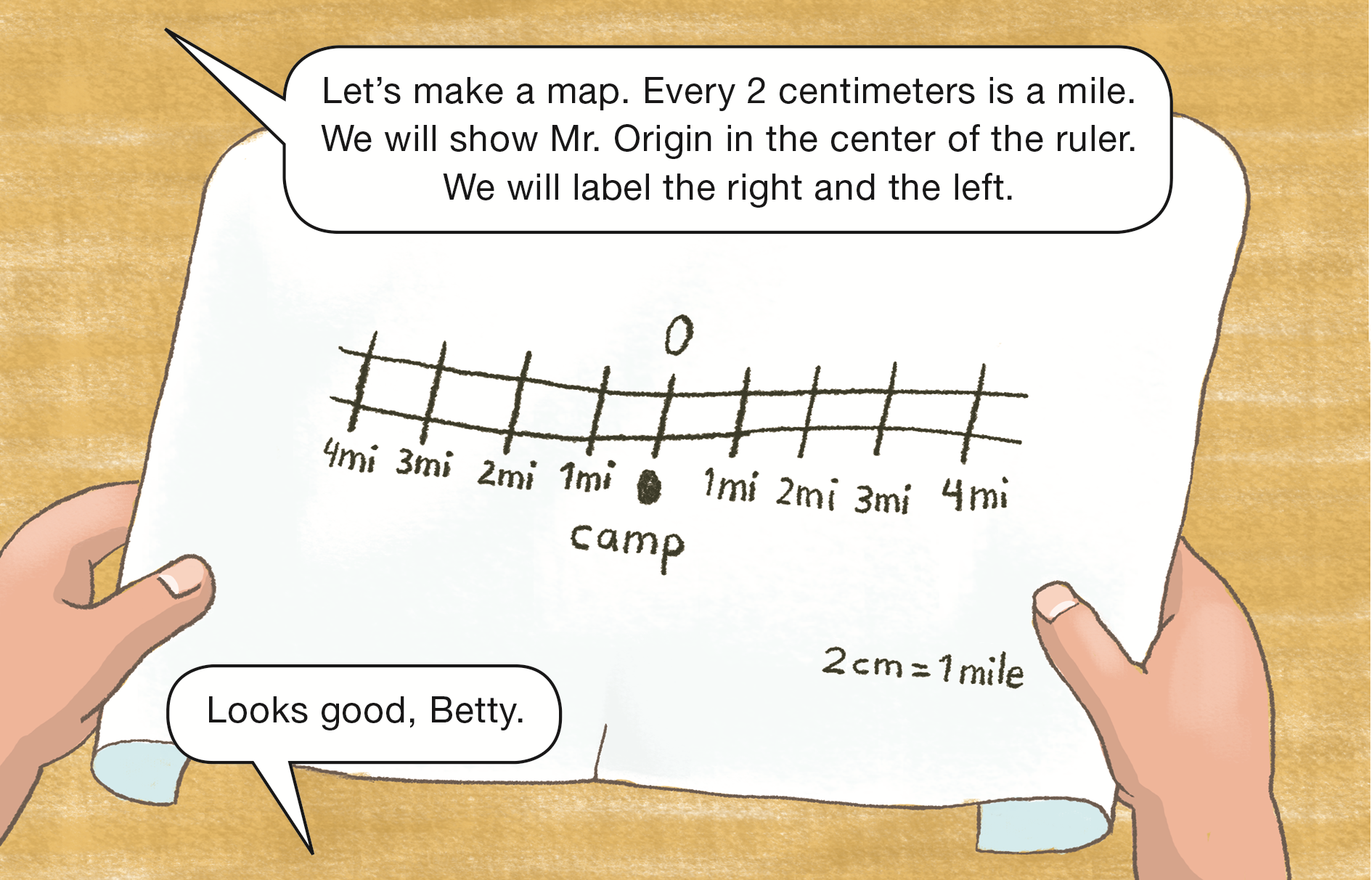
Pages 9–10
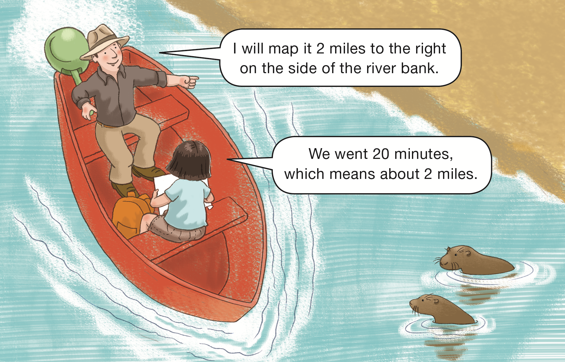
- How are Betty and her dad going to measure distance?
(Possible response: They are going to
measure the time it takes to go a mile.)
- Do you think these measurements are exact or
close estimates? (Possible response: close estimates)
- Why do you think Betty’s father chose miles as the
unit of measure? (Possible response: When they
are traveling on the river they will be going long
distances. It will be easier to use miles than
smaller units like inches, feet, or yards.)
- If Betty and her father travel 1 mile in 10 minutes,
how long will it take them to travel 2 miles on the
river? (20 minutes)
- How do you know? (Possible response: Two miles
is twice as far as 1 mile, so you need to double
the amount of time. When you double 10 minutes
you get 20 minutes.)
- How long will it take them to travel 4 miles?
(40 minutes)
- How did you find your answer? (Possible
response: Since I went 4 miles, I counted by 10,
four times: 10, 20, 30, 40.)
- If Betty and her father traveled for 1 hour without
stopping, how far would they travel? (6 miles)
- How do you know? (Possible response: There are
60 minutes in an hour. If you count by 10s until
you get to 60 you will count 6 tens: 10, 20, 30,
40, 50, 60. Each ten minutes is 1 mile, so they
would travel 6 miles.)
Page 11
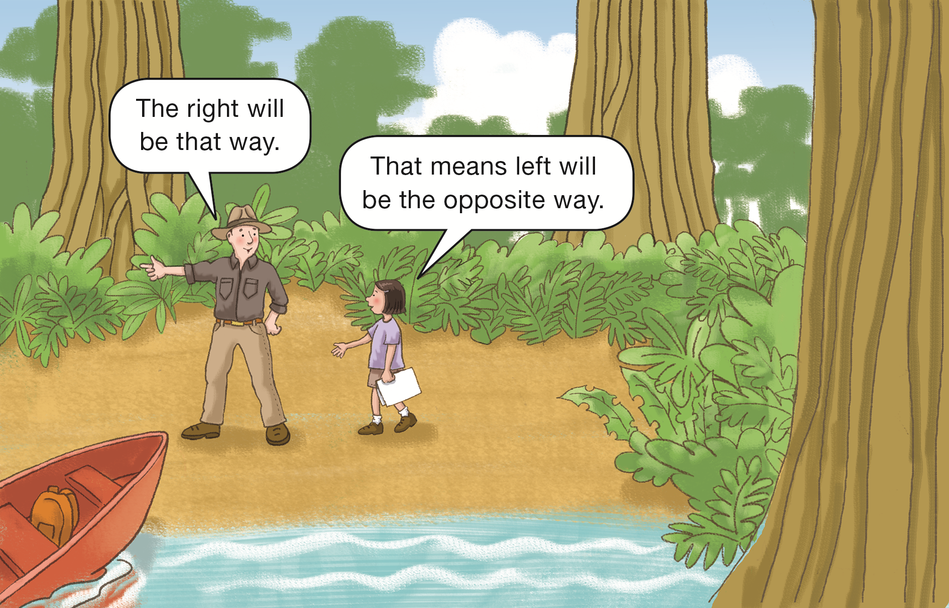
- How is the map Betty and her father made like Mr. Origin’s Map from Lesson 4?
(Possible response: Both show the distance to the right and left of an origin.)
- How are they different? (Possible response: Mr. Origin’s map was in centimeters. In the story, Betty’s map represents miles.)
Page 13
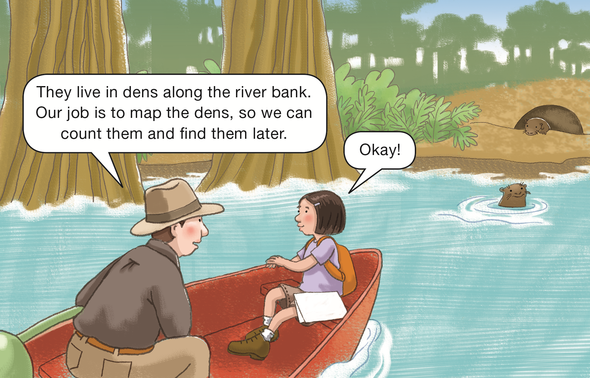
- Why is Betty mapping both the distance and the direction to show the location of each den?
(Possible response: You need both the direction and the distance to show the location of each den.)
Page 14
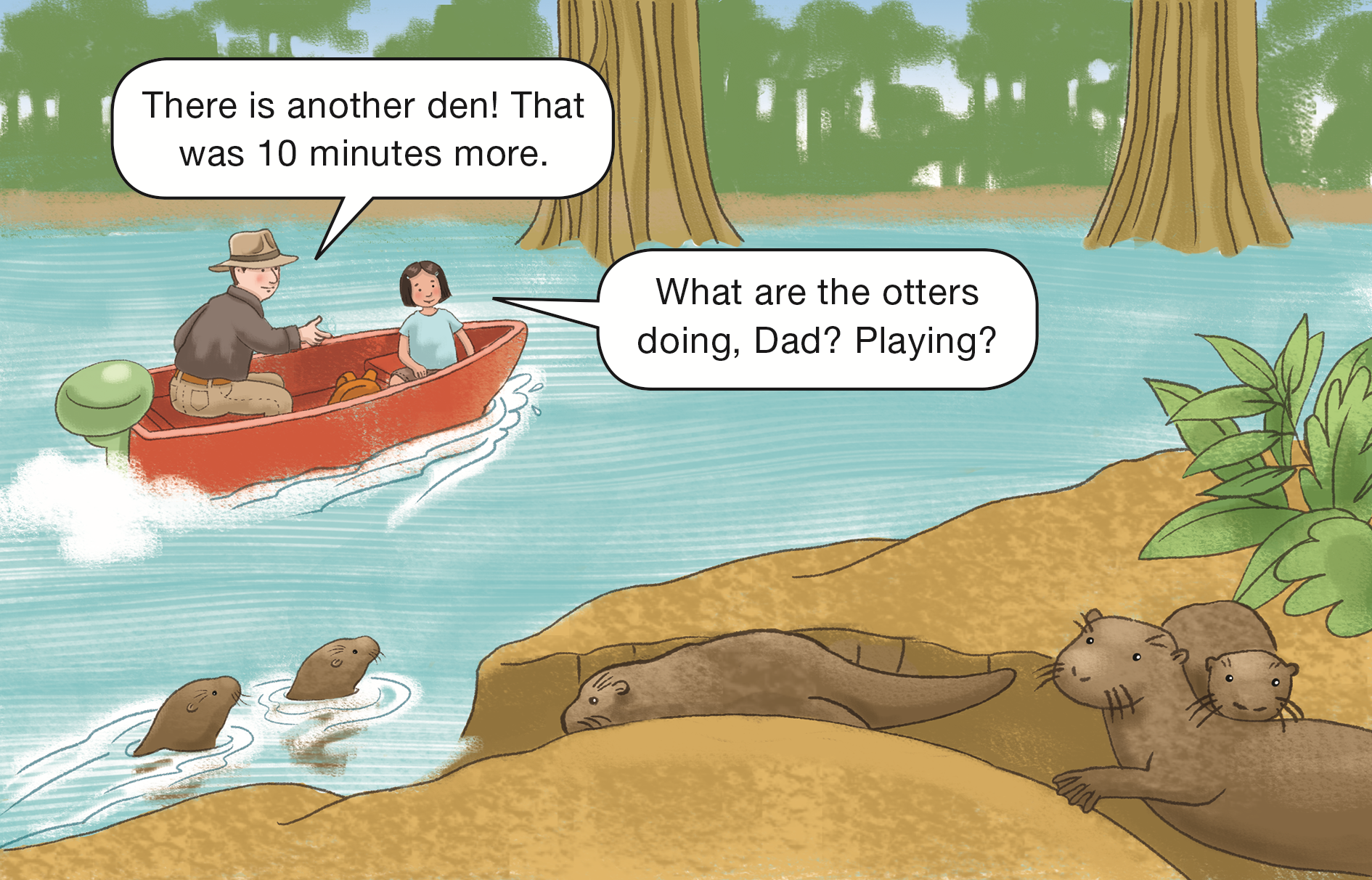
- Betty’s dad said they traveled another 10 minutes.
How many more miles did they travel? (1 more mile)
- When Betty and her father find the second den,
what is the total distance Betty and her father had
traveled from camp? (3 miles)
Page 22
- Pretend that you are going to work with Betty to
make a map of the front and back trails and you
want to start at one of the otter’s dens. How could
Mr. Origin help you? (Possible response:
Mr. Origin can help by representing the origin.
He would show you the directions to each den
using left and right, and front and back.)
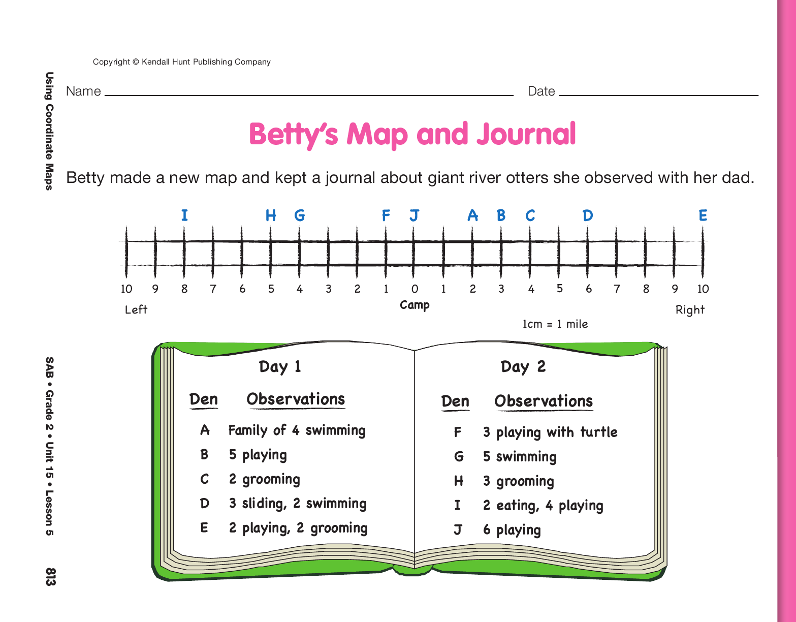
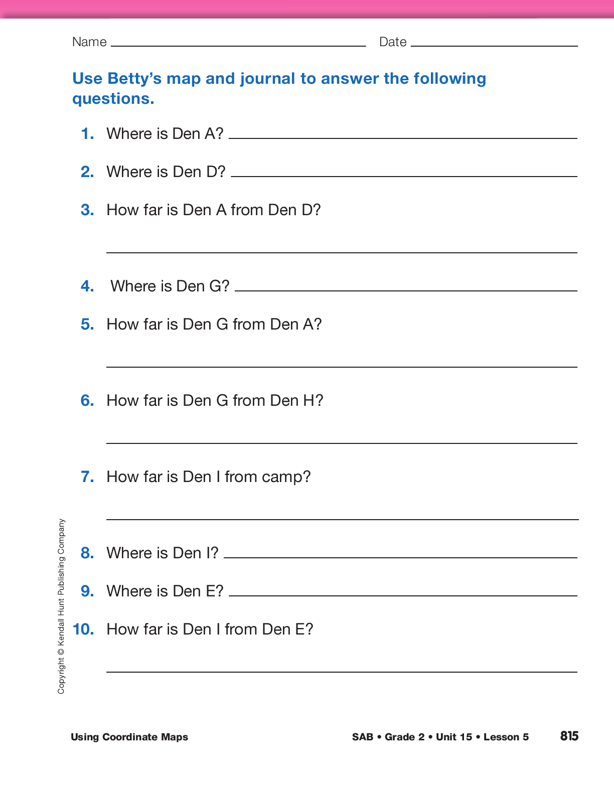
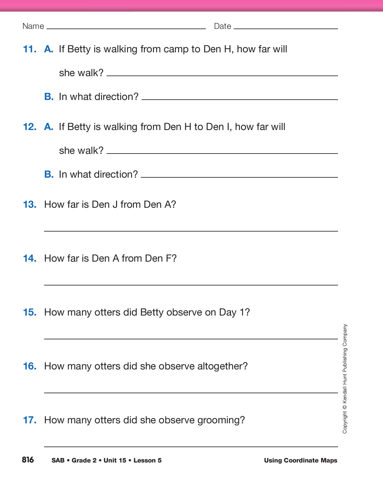
Measure Distance on a Coordinate Graph. After
reading the story, ask students to remove the Betty’s Map and Journal pages from the
Student Activity Book. Tell students that Betty and her dad collected
river otter data for two days and that Betty redrew
her map. She also collected data about the numbers
of otters she saw and things they were doing.
Ask students to work with a partner to answer Questions 1–3. After students have had a chance to
work, use the display of the first Betty’s Map and Journal page to discuss students’ responses.
- How did you solve Question 3? (Possible response: I counted the miles on the map;
I counted on from 2 miles to 6 miles and got 4 miles.)
- Can you use a ruler to check? (Possible response: Yes, I can use a centimeter ruler to measure the distance between Den A and Den D.)
Give each student a centimeter ruler and ask them to verify that the distance between Den A and Den D is
4 miles. Then ask students to work with a partner to answer Questions 4–7. After students have had a
chance to work, use the display of the Betty’s Map and Journal page to discuss students’ responses.
- How did you solve Question 5? (Possible
response: I counted the miles on the map; I know
Den G is 4 miles from camp and Den A is 2 miles
from camp in the other direction, so the dens are
6 miles apart.)
Remind students to use a ruler to check their calculations. Assign Questions 8–17. These are additional
questions about measuring distance and about Betty’s river otter data.
Use Betty’s Map and Journal pages with the Feedback Box in the Student Activity Book to assess students’ abilities to
describe the location of an object relative to an origin using direction and distance [E3] and measure length using nonstandard and standard units [E4].